Contact
Provider(s):
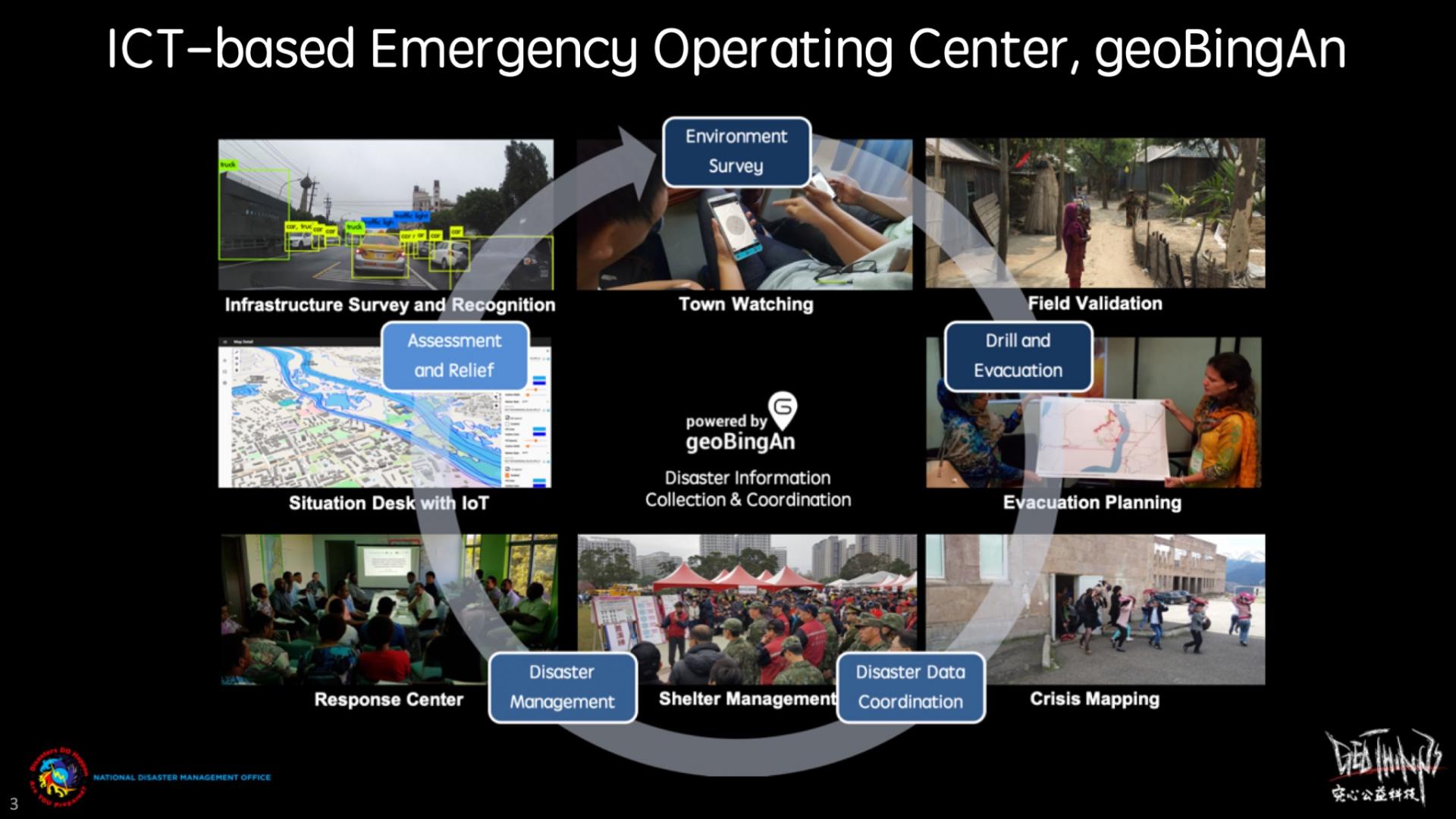
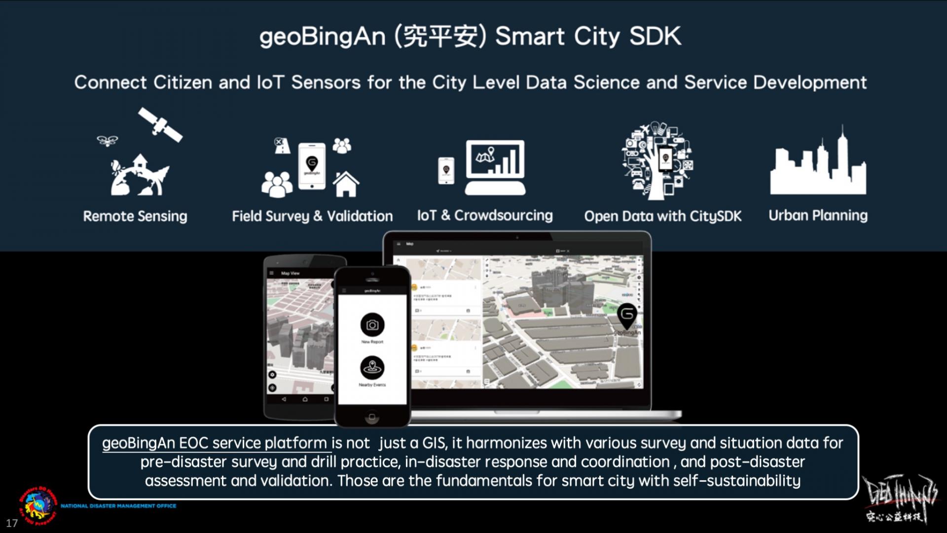
geoBingAn (pronounced Geo-Bing-An) is Taiwanese language, means “wish you all the best, safe and sound”. This innovative ICT is developed by GeoThings, allows the users to collect various sorts of data for pre- survey, in- , and post-disaster . This geoBingAn works for the field surveyors just as easy as if they were using Google Forms with OpenStreetMap features on mobile, which enable the survey activity to directly interact with basemap and immediately presented on GIS (Geospatial Information System) for later statistics. The SituationDesk of geoBingAn provides the column-based filtering in to the over-whelming incoming information during special event or .
This leveraged international open standards for the integration of crowdsourcing and IoT sensor data. With OpenStreetMap as basemap, all the visualization and statistics are much clear and easier to be presented on geoBingAn 3D GIS-based platform.
The geoBingAn service has adopted in the technical assistant project for the capacity building to disaster by Asian Development Bank, also selected by Beyond Europe project, QuinJunSAT, by Austrian Research Promotion Agency (FFG). This service is available to the communities, NGOs, NPOs, private sectors, and government agencies. now even extended for urban planning and smart city scenarios for a better sustainable tomorrow.
Supported Use Cases
geoBingAn for Asian Development Bank Technical Assistant No.8884


QuinJunSAT, a Beyond Europe project


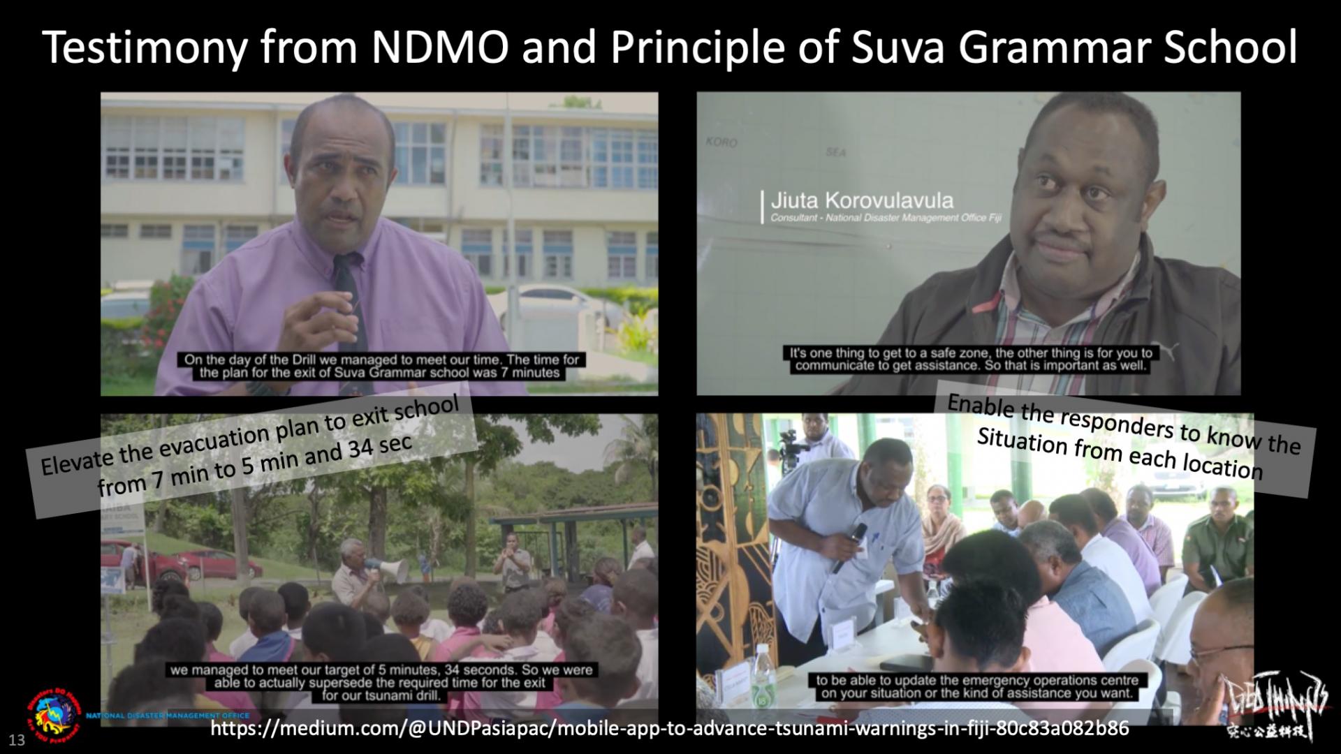
Strengthening the Disaster Resilience with ICT based EOC, geoBingAn PacWave2018 and World Tsunami Awareness Day 2019 as Practice


 |
Portfolio of Solutions web site has been initially developed in the scope of DRIVER+ project. Today, the service is managed by AIT Austrian Institute of Technology GmbH., for the benefit of the European Management. PoS is endorsed and supported by the Disaster Competence Network Austria (DCNA) as well as by the STAMINA and TeamAware H2020 projects. |